We dropped off our home at a repair facility in Salt Lake City with a long list of repairs and thankfully- with all of our issues, Fleetwood extended our warranty coverage for another month. So we were off for who-knew-how-long without our home, living out of suitcases again. But this time we wouldn't be traveling alone! Martin and Deb (who met us in Maine), were coming to join us in our adventure again- and we were thrilled! We kind of had a plan, but didn't have a plan- but were all ready to wing it:) We met each other in Moab, excited to begin our exploring in Arches National Park. Of course good food is the first sign of a good town... and we found a gem at Love Muffin Cafe.

Also found decent mexican food, though the atmosphere was the highlight.


Day 1: Arches National Park
Created as a national monument by President Hoover in 1929, Arches National Park now preserves this red rock wonderland of towering spires, balanced rocks, and over 2,000 natural stone arches.
 |
| Deb & Martin |
We took the 18 mile drive through the park, stopping along the way to photograph, climb, or even (as seen below), imitate the multitude of rock formations...
 |
| The 3 gossiping girls in front of Three Gossips rock formation:) |


 |
| Sheep Rock |
 |
| Balance Rock |
 |
| Natalie, Alayna, & Deb under Balance Rock |
Gawking at Balance Rock inspired us to create our own balancing rocks...


 |
| Jeanne & Natalie in front of Turret Arch |
Along the way we explored Wolfe Ranch. It was here, on this dry, desolate piece of land, that the Wolfe family settled in the late 1800's for over 10 years. Their 100+ year old cabin still stands today.


Our next stop led us to a lovely, yet distant view of the well-known Delicate Arch. Unfortunately, the hot, dry 90's made the 3 mile hike to it just too much for our crew.

The Devil's Garden Trailhead was our final hike of the day and led us to Landscape Arch- an amazing, narrow ribbon of stone 306' long! It is one of the world's longest freestanding natural arches. My personal fave of the day!

In 1991, a 60-foot-long rock slab fell from the 306-foot arch leaving 180 tons of fresh rock debris on the ground! Had us all wondering how much longer this one will uphold...


We were hot & tired, but needed to head to our next destination. We grabbed cold drinks & drove 4-ish hours to Bryce Canyon National Park. The start of our drive held gorgeous views of reddish-orangish rock formations & lots of sage bushes, but as we approached Bryce, the landscape changed dramatically to mountainous hills covered with forests!
Day 2: Bryce Canyon National Park


At the visitor's center a park ranger was offering peaks at the sun magnified through his telescope. We were able to see sun flares on this gorgeous, glowing orange ball!

As we stood on the rim of Inspiration Point we took in the gorgeous views of the many hoodoos. Hoodoos are the tall, skinny spires of rock seen in the photo below. Though they are found in many areas including along the Colorado Plateau and in the Badlands regions of the Northern Great Plains, their most abundant location in the world is here in Bryce Canyon. They can range in size from that of an average human to heights exceeding a 10-story building.


We then journeyed the three-ish mile Navajo Trail which led us down into the canyon.


The switchbacks leading us down 550 feet were steep and consisted of fairly slick dirt and gravel. A woman near us slipped and fell, lying unconscious for a bit. Without cell phone service or easy access out, Jim started a chain of people hollering up the canyon for help. Once we knew she was okay, we continued our hike... just a little shaken.


We were filthy by the end of our day:)


Bryce Canyon Pines Restaurant "home of the famous homemade pies" was the perfect reward to our tiring day! Though our day wasn't quite over...
At 9:30pm we headed back to the visitor's center where park rangers had set up massive telescopes in the pitch black parking lot. With dozens of other visitors, we waited in lines to get magnified views of Saturn, the moon and a "double-double" star!


Driving to this national park included major switchbacks, 2,000 foot sheer drop-offs, and tunnels built right through the rock- one being 1.1 miles long!
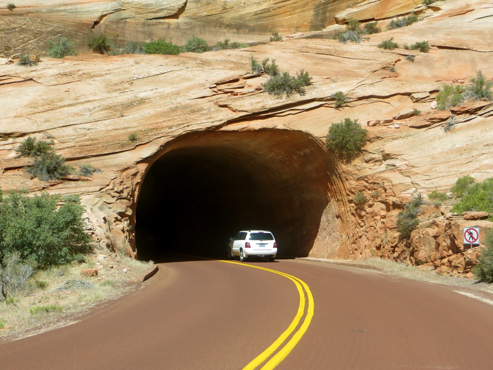
Once we landed at the visitor's center we hopped on shuttles, which were the only way to get through the park.
Court of Patriarchs, named for 3 towering figures of the Old Testament..The 3 peaks from left to right: Abraham, Isaac, and Jacob

Emerald Pool Trail


So refreshing on this 105 degree day!

Temple of Sinawava- hike along the Virgin River


After 3 full, hot days of hiking 3 national parks, we were completely exhausted... but no time to stop! We wanted to pack in as much as possible while we had Martin & Deb with us... so on we drove.

Day 4: Four Corners

 |
| Martin & Deb in Utah, Colorado, Arizona, and New Mexico! |

Other than standing in line waiting for our cheesy pictures, we spent a little time browsing the local craft stands (mostly pottery & jewelry) & trying fry bread (similar to a funnel cake topped with cinnamon & honey).


Our journey with the Cernech's continued into Colorado (which will be in the Colorado post), and after finishing our tour of that state, the four of us made it back to the RV center in Salt Lake City only to pack for our next adventure while our home continued to be repaired... Alaska!
While packing in Salt Lake we also visited IKEA (can't wait for one in KS!), had dinner at the Red Iguana (seriously delicious food!), and spent an afternoon at Park City- home to the 2002 Olympic Winter Games- to ride the alpine slides & mountain coaster.


Working on a bug collection with all this driving!

View Larger Map
A) Salt Lake City (dropped off our motorhome here for repairs)
B) Arches National Park
C) Bryce Canyon National Park
D) Zion National Park
E) Four Corners
F) Telluride (beginning of our Colorado adventure!)