Despite our recent RV repair, we were experiencing more issues. Our water pump (which provides running water in our home when not hooked up to city water) was no longer working, and -even worse- one of our inverters had again gone bad.

Thankfully the inverter controlling the lights and fridge still worked, but gone was the use of any outlets. No charging cell phones & computers. No use of microwave or other plug-in kitchen appliances. No hair straightener or blow dryer. That is, not without running extension cords in through the bedroom window!

Thankfully the inverter controlling the lights and fridge still worked, but gone was the use of any outlets. No charging cell phones & computers. No use of microwave or other plug-in kitchen appliances. No hair straightener or blow dryer. That is, not without running extension cords in through the bedroom window!


On top of our electronic issues there were snow storms predicted for the area of Idaho we'd most hoped to visit. We knew we couldn't face cold temps and the chance of no heater! So we moved our home to Caldwell, ID. And without much to do in this area, we took advantage of a couple "down" days to work on business & school work- excitedly starting to complete some of our school subjects! Only one of our days here did we venture out. Much of the southern portion of the state (where we were forced to stay) was flat & unimpressive so we drove 2 1/2 hours north to our original destination, McCall and as we ventured north, the landscape changed to bumpy, Washington-type hills, and then mountainous, pine-covered forest with beautiful views of the Payette River. Oh, what a beautiful area!
 |
| Driving to McCall |
We explored the beautiful Ponderosa State Park...


 |
| Lily Marsh |
 |
| Ponderosa Pine bark |
In a local tourist magazine, I found a small three-lined sentence about an intriguing hike in the area and we tried following the minimal directions given. We never did find the trail, but discovered the most gorgeous Idaho countryside and eventually happened upon a different trailhead.

We discovered a small trailhead sign in a remote area and decided to tuck our Jeep among the Ponderosa Pines and head out to explore (with a bit of snowfall). The Boulder Lake Trail wandered along 3 beautiful lakes and up to breathtaking mountain scenery...


Our drive back on hwy 55 followed a stretch of the Payette River. The North Fork section contains powerful class V whitewater that doesn't let up for 15 miles! We stopped to watch experienced kayakers take on the challenge:) Until visiting, we didn't realize Idaho was known for its white waters... it offers more whitewater river miles than anywhere in the lower 48 states!


 |
| This area, known as Devil's Orchard, was so named because of a minister who visited in the 1800's, declaring this jumble of rocks, shrubs, and trees to be "a garden fit for the devil himself". |
Though seemingly barren, the landscape sustains a surprising diversity of plant life upon closer inspection. We were lucky to visit while the wildflowers were in bloom.


 |
| This Inferno Cone is a cinder cone that was formed by a vent off in the distance that spattered volcanic cinders high into the air, dropping them into huge mounds like this. |
 |
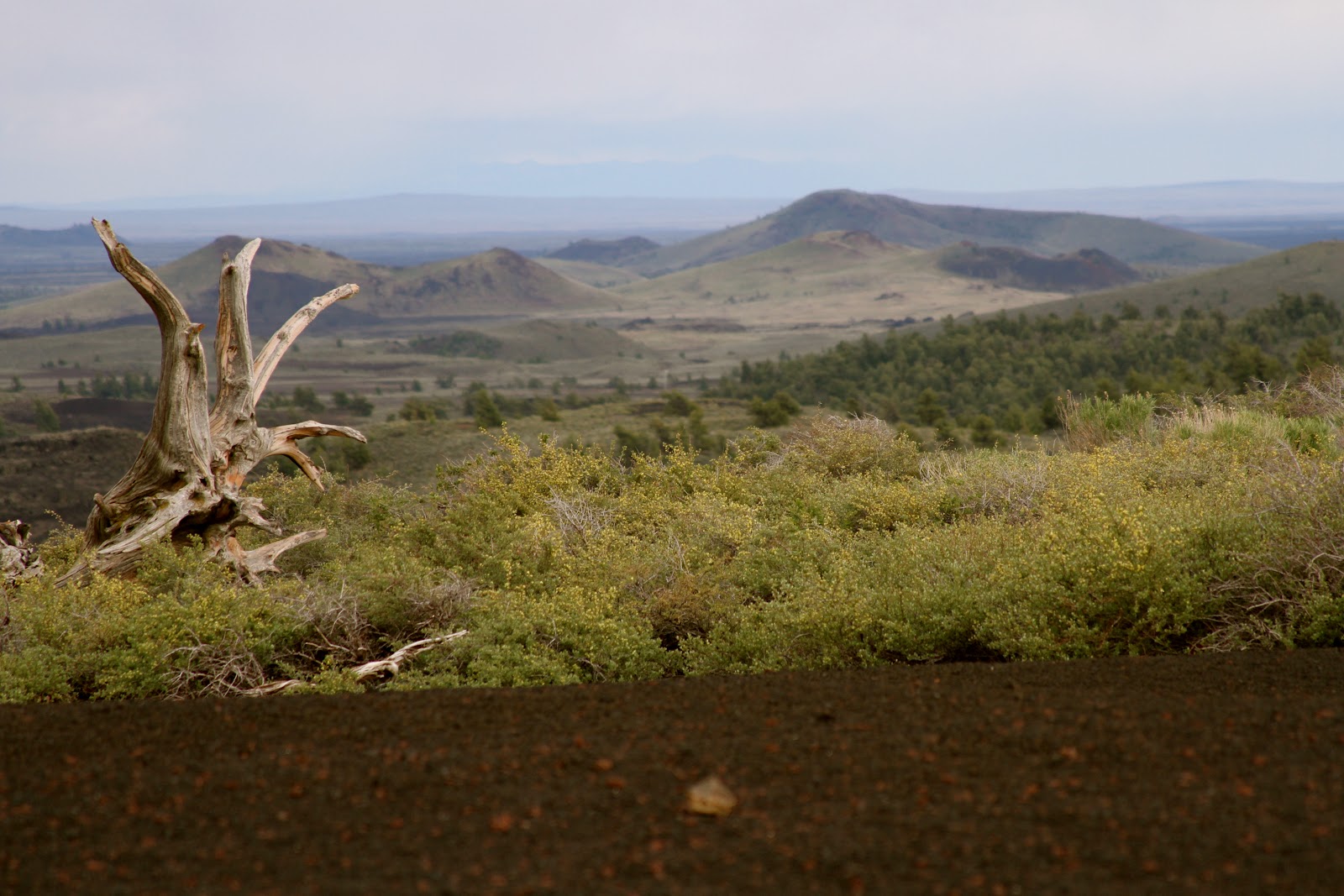
| This Inferno Cone Overlook captured views of the Pioneer Mountains & Lost River Range |


 |
| Climbing a spatter cone, or mini volcano |

 |
| Alayna standing over a huge lava tube |
Exploring one of the many lava caves in the park, we ventured down into the cave, traversed over large rock piles, and exited through the tiny hole of Indian Tunnel which is 30 feet high, 50 feet wide and 800 feet long (and the only cave in the park not requiring flashlights to see!)


The three following photos each contain a BASE jumper... just specks in comparison to the bridge and canyon!


In 1974, with crowds watching, Evil Knievel attempted to jump the Snake River Canyon in his "sky cycle" (dirt ramp shown off in the distance in photo below). His parachute deployed immediately after launch, and he floated -strapped to his cycle- to the bottom of the canyon near the river's edge making his endeavor unsuccessful.


The rest of our Idaho time was spent in campground laundromats, as our electricity was still out of service. A 2 1/2 hour drive brought us just south of Salt Lake City to Draper, Utah where we dropped off our home for much needed repair and unfortunately had to tour the next few states without it.
View Larger Map
A) Caldwell, ID
B) McCall, ID
C) Craters of the Moon
D) Twin Falls, ID
No comments:
Post a Comment